

After leaving El Morro we drove to Albuquerque, NM and stopped at the Walmart/Sam's Club for the overnight. I had been here many years ago (1969) when I road my Triumph bike from Virginia Beach to San Francisco on my way to Viet Nam. I did not go to the crest so I decided we'd drive up to the top. And as in most cases with being on top of mountains, the views did not disappoint. What we didn't expect was the 12 degrees change. Burr! 62 to 50.. we survived though.

From Wiki: The range is largely within the Cibola National Forest, and part of the range is protected as the Sandia Mountain Wilderness. Its highest point is Sandia Crest, 10,678 feet.

Wiki: Sandía means watermelon in Spanish, and is popularly believed to be a reference to the reddish color of the mountains at sunset. Also, when viewed from the west, the profile of the mountains is a long ridge, with a thin zone of green conifers near the top, suggesting the "rind" of the watermelon. However, as Robert Julyan notes, "the most likely explanation is the one believed by the Sandia Indians: the Spaniards, when they encountered the Pueblo in 1540, called it Sandia, because they thought the squash gourds growing there were watermelons, and the name Sandia soon was transferred to the mountains east of the pueblo." He also notes that the Sandia Pueblo Indians call the mountain Bien Mur,
"big mountain".


As you can probably see, it was pretty late in the evening and the breeze fairly light, but enough to make the wind chill feel like 48, and I was in shorts and t-shirt. Below is Albuquerque. I hope I am spelling that city correctly.


Miss Nancy blazing the high trail...

There is a tramway over on the other side of the crest, along with a ski resort. My nephew who lives down El Paso way and his wife and son go hiking here and skiing.


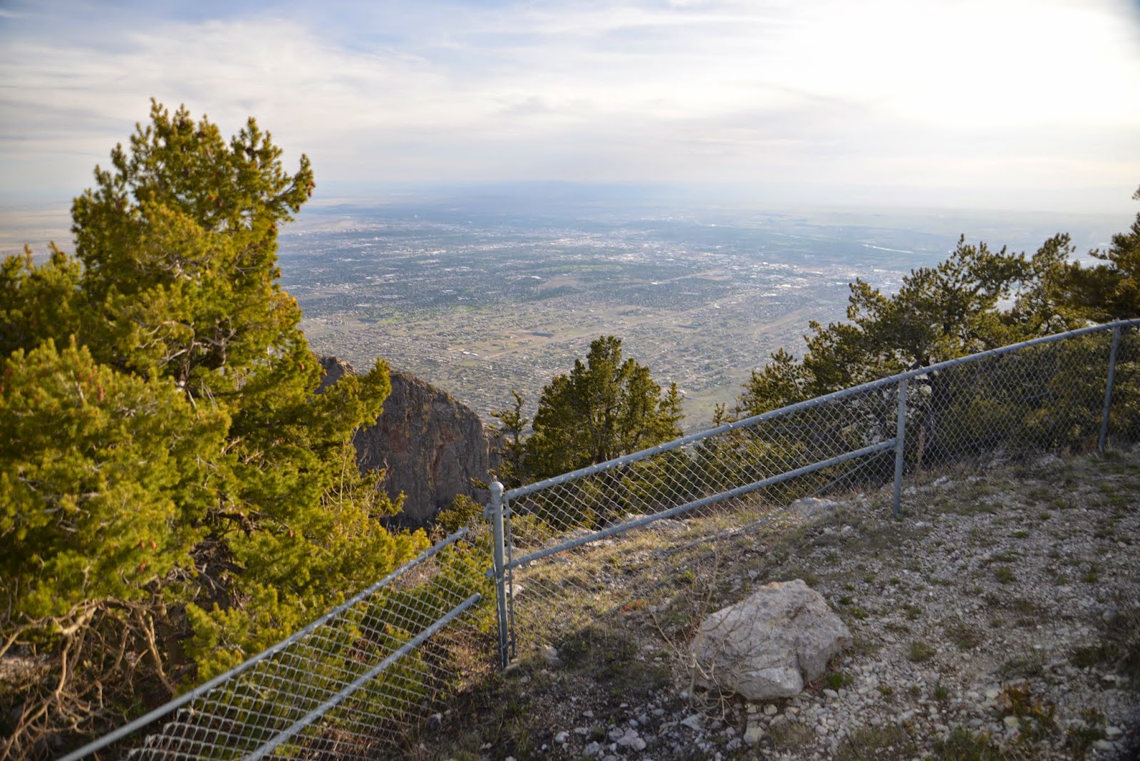
Above, the 'burbs just east of town on the slope of the crest...below, and closed, cause it's after 5:30 darn it, is the visitor/gift/snack bar and grill. I could have used a cup of coffee and pair of "britches" too. :-)


Not sure the exact height, (oh it's in the above pic silly) but it must be about two miles high (below). The air was a little thin as I remember.


Above, the antenna farm for a lot of comms for someone in town. Microwave and relay and emergency I would assume.


I can't say anymore than these story boards can, so I won't try.


Above, looking east...

And that's about all I remember, except for one unpleasant event later that NIGHT!$#X*&^%X We had permission from a security guard earlier when arrived at Walmart, to spend the evening. At about 1 in the morning, with a strong wind (our slides were definitely closed) rocking us for hours prior to, we were awakened with a loud knock. Another security guard said we had to move out of Walmart, so we said ok, and moved to Sam's, about 100 yards away, and he was satisfied. Now mind you, this parking lot had no one in it, but us. Go figure. A little snippy whippersnapper using a little authority. Most frustrating.
RVing Beach Bums signing off. This blog published contemporaneously from Lakewood, WA Panera's, Wed, July 8, 2015.
No comments:
Post a Comment