

I remember going thru this town about 45 years ago on my Triumph Bonneville when I drove it from Virginia Beach to San Francisco, via Route 66, a lot of the way. I think it has shrunk some. It just seemed to be bigger from my "young eyes". But that doesn't mean that Falls Park isn't one of scenic, relaxing falls, in a park, in the middle of city.


We parked at our favorite RV park, Walmart in town on Monday evening, Sept 23. I had vaguely remembered staying here in this town in Sept of 1969, and I think I stayed at a firehouse, as I often did on my way to San Fran (Travis AFB, to catch a plane to Clark AFB and eventually my aircraft carrier USS Hancock).

From Wiki: Sioux Falls is the largest city in South Dakota. The metropolitan population of 228,261 accounts for 28% of South Dakota's population. The history of Sioux Falls revolves around the cascades of the Big Sioux River. Ho-Chunk, Ioway, Otoe, Missouri, Omaha (and Ponca at the time), Quapaw, Kansa, Osage, Arikira, Dakota, Nakota and Cheyenne people inhabited the region previous to European descendants. Numerous burial mounds still exist on the high bluffs near the river. Lakota populate urban and reservation communities in the contemporary state and many Lakota, Dakota, Nakota, and other Indigenous Americans reside in Sioux Falls today.

So, I just thought that it would be nice to pass by this way and refresh my memory of these lovely falls. Ah, retired life on the road in big wheels; it is hard to beat...


Here are few pics of the long abandoned power plant, restored, to still be a part of the recent history of the city, and of the falls. It's hard to believe the money investors spent to build this enormous mill, only to find out they couldn't get enough water (or grain too) to the mill to ever fully realize the true capacity of the mill. After only two years, it closed. What a waste!


Below, the sluice control house where the large diameter pipe passed thru and on down to the wheel of the mill house.

Below, the large concrete pond that was constructed to "hold" water that was diverted from the river, and then out the two large pipes, and on into the sluice control house. I found this whole idea very ingenious and intriguing. But obviously, more research should have been done prior to dumping all the money into the project.

Below, another view of the control house.


I want to bring to your attention the color of the stones and layers of rock along this river. It is pink colored, and it is quartzite. I will blog about a stone that lays deep under the this pink rock next time, as I explain the long sought-after Pipestone Rock.


Had to get Miss Nancy, my best friend, travel companion, and wife of nearly 46 years, in the evening sun.

I want include a couple pics here that I took along the way, at stops where we didn't spend a lot of time, or there just wasn't much around at those places.

For example, after leaving the White River Visitor Center up in the Badlands, I wanted to drive down to Wounded Knee, SD. I've heard about this place in our not-so-famous-annals of our past history, especially with our Native Americans, truly the First Nation of North America. None of us can be proud of the actions taken then, or the politics of how we treated our friends and fellow countrymen. There have been numerous books and ideological papers written from various perspectives, and I'm fairly certain that political agendas can be justified, depending on one's perspectives of course, but we just blew it too many times over that 50 year period or so where there was so much conflict & hardship, from any perspective. It just makes me sad!

We drove away from Wounded Knee and on into the small town of Rushville, NE.
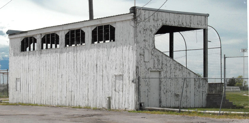
The pic above is from the web and I realize it is a little larger than I usually, post, but I wanted it here to show you where camped for the night, right behind these stands. If you want to learn a little nostalgic history of this little ball field & the persons who were responsible for it's being, go to this link: http://www.nebaseballhistory.com/rushvillefield.html It was at the Modisett Park, in Rushville. Now, I had never heard of Rushville before we drove here. In fact, I have never heard of most of the small towns we visited on this, our 2013 journey thru our great country, including Canada & Alaska. But that's part, if not all, of what makes doing what we are doing: Adventurous! Exciting! Exploring!

From home plate inside the ball park above, I snapped a few pics of the gorgeous sunset over the left field fence, where I would have hit home runs, had I ever played here. :-) The sunset pics are a little blurry, as I had the lens zoomed all the way and hand held camera.

The joys of being able to do what we do are sometimes hard to explain, but I will tell you this: I wish everyone could do what we have done. I hope our blogs have helped, in sharing the joys and journeys we have experienced. I realize that traveling near full time isn't every one's cup of tea, and that's ok. But, wow, what a ride it's been so far. Thank you Lord for that experience, and to YOU be the glory! Till the next time, RVing Beach Bums.
No comments:
Post a Comment