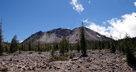
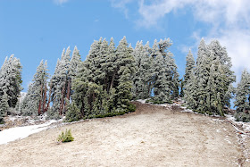
We left Travis AFB Friday, June 29 headed north. We settled the RV in Anderson, CA, just south of Redding, at the Sacramento River RV Park. Saturday morning we got up and drove to Lassen Volcanic National Park. It was about 35 miles east of Redding off HWY 44.
A tall set of peaks just north of Lassen Peak. Note Lassen in the background in the pic.
It was a little nippy, but just a long was all that was needed. Four young boys were having a snowball fight, and I nearly got winged by one. Lucky for them it missed. :))
From Wiki: Lassen Volcanic National Park is a National Park in northeastern California. The dominant feature of the park is Lassen Peak, the largest plug dome volcano in the world and the southern-most volcano in the Cascade Range. LVNP started as two separate national monuments designated by President Theodore Roosevelt in 1907: Cinder Cone National Monument and Lassen Peak National Monument.
Note the frozen lake.
The visitor center and the old seismograph building.
The former museum dedicated to Benjamin F. Loomis stands near Manzanita Lake, welcoming visitors who enter the park from the northwest entrance.
Miss Nancy reading to me the geographic features from the story boards. Below is just to the right of these info boards.
Burrrr...
Some of the active geothermal activity going on in the park. The largest area of activity was closed due to deep snow. Other areas in the park include the area in between Lassen Peak and Brokeoff Mountain that is thought to mark an area near the center of Tehama's now-gone cone, and areas in the caldera are Little Hot Springs Valley, Diamond Point (an old lava conduit), and Bumpass Hell Trail.
So, our visit to Lassen NP comes to an end. Our next blog will report our visit to Lava Beds National Monument. So, please return soon and see where I ventured. It was a challenge for me. Till then, Joe & Nancy headed back to Anderson and the RV.


Great tour, it will definitely go on the list)
ReplyDelete