From wiki: The many settlement sites scattered throughout the monument were built by the Ancient Pueblo People, more specifically the Sinagua, Cohonina, and Kayenta Anasazi. Wupatki was first inhabited around 500CE. A major population influx began soon after the eruption of Sunset Crater in the 11th century (between 1040–1100), which blanketed the area with volcanic ash; this improved agricultural productivity and the soil's ability to retain water. By 1182, about 85 to 100 people lived at Wupatki Pueblo and by 1225, the site was permanently abandoned. It was a 100-room pueblo with a community room and ball court; making it the largest building for nearly fifty miles.
We left Grand Canyon NP on Tuesday and drove west towards Cameron on AZ 64. We then turned south on AZ 89 towards Flagstaff ans stopped by Wupatki and Sunset Crater National Monuments. The weather was nice, sunny and mild, but I could sense that was about to change.
The Wupatki Community Center lower right. It resembles a sports ball park of that period, but we were told it wasn't.
Up the road from the main ruins at the visitor's center, there were numerous other pueblo ruins.
Lower pueblo and the main pueblo on the hill top. Note the two ladies on top.
View from the north side of the hill top pueblo. Note the guardian Raven. Is it really a Raven or a spirit from many generations before?
I nearlly touched this raven and he didn't move. It was like, I am the guardian, so don't bother me while I maintain my vigil.
From the top of the pueblo looking at Humphrey Peak in the San Francico Range, near Flagstaff.
On down the loop road from Wupatki NM about 15 miles we visited Sunset Crater NM. The surrounding landscape was eerily different than anything we have ever witnessed, except for when we were on the big island of Hawaii and saw Kilauea many years ago.
From wiki: Sunset Crater Volcano National Monument is a U.S. National Monument in the north-central part of the U.S. state of Arizona, intended to protect Sunset Crater, a cinder cone that is part of the San Francisco Volcanic Field.[5] It is maintained by the National Park Service in close conjunction with nearby Wupatki National Monument. Damage from hikers forced the National Park Service to close a trail leading to the crater, but a short trail at the base remains.[4]The hiking trail below the summit skirts the substantial Bonito Lava Flow. This hardened lava is black and appears fresh as it has devastated the forest in its path. The lava flow also created an ice cave or tube that is now closed to the public after a partial collapse.
Lava from 1000 years ago...
This photo was taken from half way up the trail to Lenox crater.
Ponderosa Pines and other flora grow right up out of the lava ash.
View from the Coconino Park about five miles away.
From the Coconino Park pull out, a view of the Humphrey Peak reveals that weather is about to change, and drastically. It began to snow on the way back to Flagstaff and Walnut Canyon NM. YUK!
From Wiki: Walnut Canyon National Monument is a United States National Monument located about 10 mi (16 km) southeast of downtown Flagstaff, Arizona, just off Interstate 40. The canyon rim lies at 6,690 ft (2,040 m); the canyon's floor is 350 ft lower. A 0.9 mi (1.4 km) long loop trail descends 185 ft (56 m) into the canyon passing 25 cliff dwelling rooms constructed by the Sinagua, a pre-Columbian cultural group that lived in Walnut Canyon from about 1100 to 1250 CE. Other contemporary habitations of the Sinagua people are preserved in the nearby Tuzigoot and Montezuma Castle national monuments.
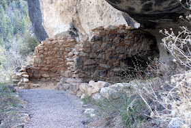
Miss Nancy under one of the many cave-like shelters in the side of the canyon. The ancient structure that once was at this location has since been vandalized and weathered away to a pile of rocks.
Preserved ancient dwellings...
Preserved cliff dwellings...
Miss Nancy inside one of the rooms. Note the ancient smoke stained walls and ceiling.
Across the canyon and virtually on every side of the canyon walls were numerous cliff dwellings.
Miss Nancy walking up one of the 240 steps out of the canyon, and at 7,500 feet altitude. Whew!
Some visitors from Canada pausing at one of the many interpretive plaques overlooking the canyon.
Another view looking east of the Walnut Canyon, just east of Flagstaff. Well, guess we better mosey on for now. Our motorhome has a problem with the coolant reservoir leaking, so we are stuck in Flagstaff for now (Friday 4/8) waiting for a part from Monaco. And guess what? It is snowing and they are expecting a foot of it tonight. PLEASE! Get us out of here, and quick! YIKES! Joe & Nancy, till the next time.


Thanks for a great tour. Good luck with the snow and spare parts.
ReplyDeleteyikes!..hope you get the repair done quickly and you can get out of there soon!
ReplyDelete