From Wiki: Canyonlands National Park is a U.S. National Park located in southeastern Utah near the city of Moab and preserves a colorful landscape eroded into countless canyons, mesas and buttes by the Colorado River, the Green River, and their respective tributaries. The rivers divide the park into four districts: the Island in the Sky, the Needles, the Maze, and the rivers themselves. While these areas share a primitive desert atmosphere, each retains its own character.[1] The park covers 527.5 square miles (1,366 km2). Canyons are carved into the Colorado Plateau by the Colorado River and Green River.
On Tuesday (4/22) we drove into the Island in the Sky section of CNP, which happens to be the most accessible section, as well as being almost out our back door from Dead Horse Point SP Campground.
There were many pullouts to overlook the beautiful and awesome canyons and valleys below, including the Colorado River meandering it's way through the Moab country. As we peered into these deep canyons, we noticed a lot dusty roads along the river rim and all over the flat lands of the valleys. On one of the interpretive plaques we read that the Moab area at one time had many uranium mines scttered throughout the valleys. All of these roads from the early '40s to the mid '60s were built by the mining companies to haul out the ore. When the Park was opened in 1964, most of the roads were never used again. However, a lot of them remained opened and are maintained somewhat by the NPS and local OHV clubs. Well, when I learned about the Red Rock 4-Wheelers Club of Moab, I did some research and learned that there were many off highway roads to discover. And in a Jeep, WOW, what a mecca.
Nancy caught me in a weak moment. Photo is looking south from Grandview Point in Island in the Sky section of CNP.
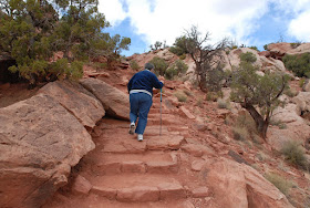
We did a little 2 mile hike to an interesting peak.
So, there is some discussion among the "learned geologists" as to what and how this dome really is.
I tried to get Nancy to go ahead and push off this VW size rock over the side of the mountain.
Two geologists from a local university were explaing to their students how this rock was formed and where it came from. Does anyone really care?!
This doesn't look very far away, however, I was zoomed out here with 280mm, and it still is a far piece. I would gues about 10 miles.
Green River making it's way to the Colorado.
So ends our time in the Island in the Sky. Remember those little roads I mentioned earlier in this blog? Well, we decided to get up tomorrow and go 4-wheeling. Next blog: Shafer/Potash Road from Island in the Sky to Moab, 50 miles, 35 of those miles off-road. So tune in to our next blog to learn how that went. Till then, Joe & Nancy, the RVing Beach Bums.


once again great shots..thanks for the tour!..NOW lets go four-wheeling!!!
ReplyDeleteGreat pictures and tour today!
ReplyDeleteThanks for the excellent tour and the even better photos!
ReplyDeleteJohn
relaxedrush.blogspot.com