Joe and Nancy

Joe and Nancy
Our Home on Wheels (Click on image above for our web albums.)

Monday, July 23, 2012

Watford City, ND & Our Broken Windshield

After we left Fort Union Trading Post, just south of Williston, ND, we took off down HWYs 58 & 200 for Watford City Tourist Campground.  It was really HOT!  97 degrees and thunderstorms on the horizon (above).  Do you recall reading about the oil boom going on in north west North Dakota?  Let me tell you:  It is absolutely a boom situation in this part of the country, yes country, not just North Dakota.  We have never seen so man trucks and tankers of all sizes and shapes and any & all support services one can imagine going on here.  We have never seen so many makeshift campgrounds with thousands of campers set up, temporary housing homes, mobile home-motels, comnstruction everywhere, and oh, did I mention oil tanker haulers?  Guess what?  When they are on the road, you are taking chances with your life, as they know only one speed on those two lane narrow speedways (roads).  Look what one of them did to our windshield when one went by us at about 100mph.  We have these large cracks from top to bottom and nearly all the way across.  I'm really afraid to drive it very fast.  We are on our way to Elkhart, IN to have it replaced by our insurance company, with a $1,000 deductible.  Ouch!  Wednesday morning, July 25, is our appointment.
 We only wish we would have taken some pics of the many housing communities all over this part of the state.  After left here the next morning, we saw so many more down the highway, south, towards Theodore National Park, at Medora, ND, right along I-94.  They are just everywhere, and so many more trucks down on I-94 all heading to this boom area with services & supplies.  The Walmart in Williston was not even taking their stock off the pallets when their semis rolled in.  They just unload the pallets and leave them under large tents in the parking lot, and men just buy stuff by the cases right off the pallets. 
 There must be 200 of these drilling rigs all over this area, and this is not counting the ones already drilled and pumping crude oil & natural gas. 
We got up Friday morning, July 20, and headed south towards Theodore National Park, and the Red Trail RV Park in Medora, ND.  The next blog will cover our visit to this strangely beautiful national park.  So till then, Joe & Nancy driving the big (vibrating) wheels down HWY 89.  More about those wheels then too!


Fort Union Trading Post NHS, ND/MT

After visiting the Bear Paw Battlefield in Chinook on Tuesday, July 17, we drove on down Route 2 to Glasgow, MT. It was too warm (90's) to drycamp and run the generator all night for the A/C, so we opted for Shady Rest RV Park. Nothing fancy here, and the 50A service was weak, so we couldn't run all three units at once, but that was ok. We ran the bedroom unit and it did just fine. We got up Wednesday and headed for the North Dakota stateline. It takes as long to drive across Montana as it does Texas it seems.
We had done a little research and found that ND had little in the way of National Parks & Monuments.  But we knew we wanted to take in the trading post, which is located on the stateline, literally!
 We parked in Montana and walked across the line to ND where the post sits.  Most interesting.  I thought it amusing that the park service put these little reminders up for one to notice the set up here. :))
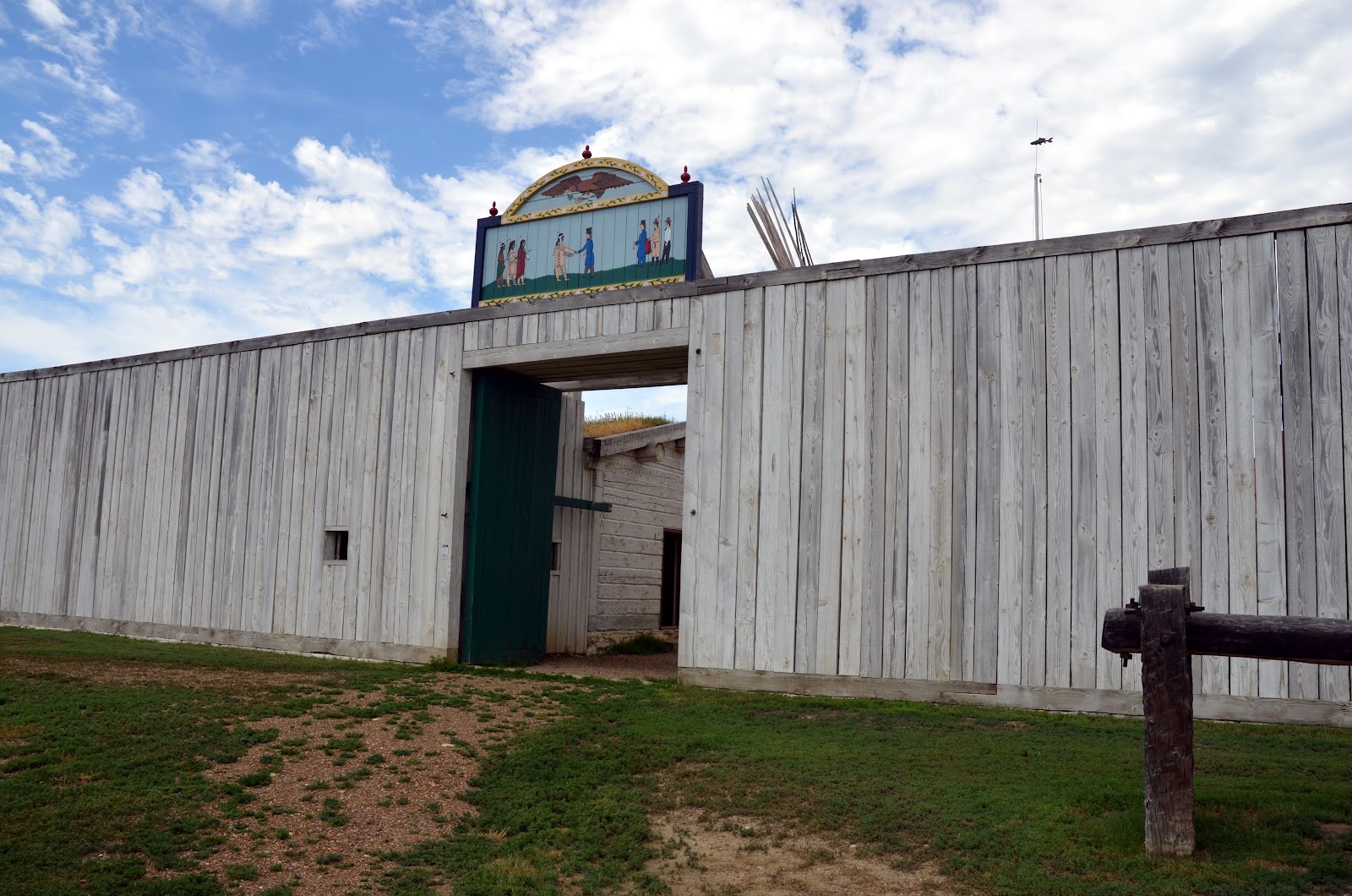
From Wiki:  Fort Union Trading Post National Historic Site is the site of a partially reconstructed trading post on the Missouri River and the North Dakota/Montana border twenty-five miles from Williston. It is one of the earliest declared National Historic Landmarks of the United States. The fort, perhaps first known as Fort Henry, was built in 1828 or 1829 by the Upper Missouri Outfit managed by Kenneth McKenzie and capitalized by John Jacob Astor's American Fur Company. Today, the reconstructed Fort Union memorializes a brief period in American history when two cultures found common ground and mutual benefit through commercial exchange and cultural acceptance.
 The original structure was disassembled around 1880 and reconstructed east about a mile and renamed Fort Buford, which today is a state park.
 Much of the internal structure was not rebuilt in the 60s when the site was rebuilt and declared an NHS.  But the guide sheet explains where all the original buildings stood at the time.
 The large beams on the ground above, and others located on the opposite of the post represent the locations of the former structures.
 And the info plaques also tell part of the story of the fort as well.
 This lovely mansion-type structure housed the post commander and other managers and leaders at the time.

 The ranger dressed in period clothing was role playing as a trader and gave a talk on the post and just how the trading took place, and all the events necessary to have a successful negotion with all the parties of Indians coming from far and wide to trade their furs and other wares. for the eastern products brought to the post from the steamers sailing up the Missouri.
 Above, beaver pelts, and below a buffalo fur.  We were in shorts and tee shirts as it was in the 90s and very humid.  In fact it sprinkled a little while we were listening to the talk.  This ranger was sweating pretty good!
 In this room, in front of the fireplace, buffalo rugs were laid on the floor, and the parties settled in and began the 6-8 hour of ceremony and formalities before the actual trading took place.  The ceremonies were necessary.  It got everyone in a happy and trusting environment where the best negotiations could ocurr.
 Here a few of the period items that were in the trading posts inventory.  Some of these items were part of the "gift" inventory that the post traders gave the Indians as a good will gesture, to get the mood right, so to speak.  Some of these gifts were pretty elaborate, like the colorful uniform coat above, or perhaps a prized Jim Bowie knife, or a much desired Spencer repeating rifle.  Below was the Quatermaster's table and log book of items traded.
 It was hard for me to fathom the fact that the river bank at the time was just to the right of the tall brown grass below.  The steamers and Indian boats/canoes tied up with 50 yards of the Fort's gate.  The river's couse has changed over the past 130 years to it's present cousr (above) about a half mile away.  Wow!
 Well, it's hot, and threatening a storm, so we scurried on out of the Fort and headed for the big wheels in Montana.  (We are standing in North Dakota above, remember?)  We need some A/C quick.  We are both in need of cool air and a shower.
So we left North Dakota for Montana, only to cross back into North Dakota (confusing?) on down ND routes 89 & 200 and on into Watford City.  Oh, do you remember reading recently about the oil boom in North Dakota?  Well, we were right smack dab in the middle of the boom area.  It was kinda exciting, but scary.  And it got real scary.  More about that in the next blog.  Till then, RVing Beach Bums looking for a shady spot in Watford City, ND.


Sunday, July 22, 2012

Chinook, MT & Bear Paw Battlefield

We got up Monday morning, July 16 and headed out of Whitefish, MT headed for points east on HWY 2. We knew this route was a two lane road and around the boundary south of the park. And of course the first 60 miles or so would be hilly at best. That's ok because we are seldom in a hurry. And as a result, not much distance was covered today. So we drove to a little prarie town along the BNSF Railroad, Shelby, MT. This was a small store (the only store in town) and we were quite surprised when the manager invited us to spend the night in his small parking lot.
 We didn't patronize his store as the prices were very high.  We did get a box of Ritz wheat crackers to make it look good.  We'll wait for Walmart down the road for our groceries.  Oh, the railroad:  It was noisy, as we expected, especially being only 100 yards away, but the big derailment just east of Glasgow about 30 miles east, traffic came to a halt around midnight.  So we slept well.
We got up Tuesday morning and headed out on the prarie and on down the two-lane HWY 2. We chose this route before we ever left Whitefish, hoping to see a little more than going down a freeway. We were right of course. But really, how much of the prarie grasslands can one take in? After a while, it pretty much all runs together, wheat, rye, flax, oats, and every other grain one can think of. And grain elevators and rail transport cars, countless. Truly, this is the bread basket of the world, literally!
We drove on till we came to a small town (Chinook) that displayed a sign to this historic landmark.  I have been reading several books on our Native American pre-forefathers while traveling the past several weeks.  I am wanting to know more & more of their plights and culture.  And of course in this part of the country, one of the tribes is the Nez Perce.  Of couse we diverted to this place for a brief interlude.  We disconnected the Jeep as the road down to the battlefield was being tarred and graveled, and we didn't want tar all over the big wheels.   
 The site is about 20 miles south of town on a small road, and is right in the middle of the Montana grasslands.  There was a 1.5 mile interpretive-storyboards walk, so we did it, in spite of the blazing sun and near 90 degrees.  Instead of going into the walk, I'll the info boards tell the story.
Harrier Hawks were nesting in the bush on both sides of this bridge, so we were encouraged to hurry on across.  We didn't see any, thankfully, as they can be quite defensive of their nesting areas.
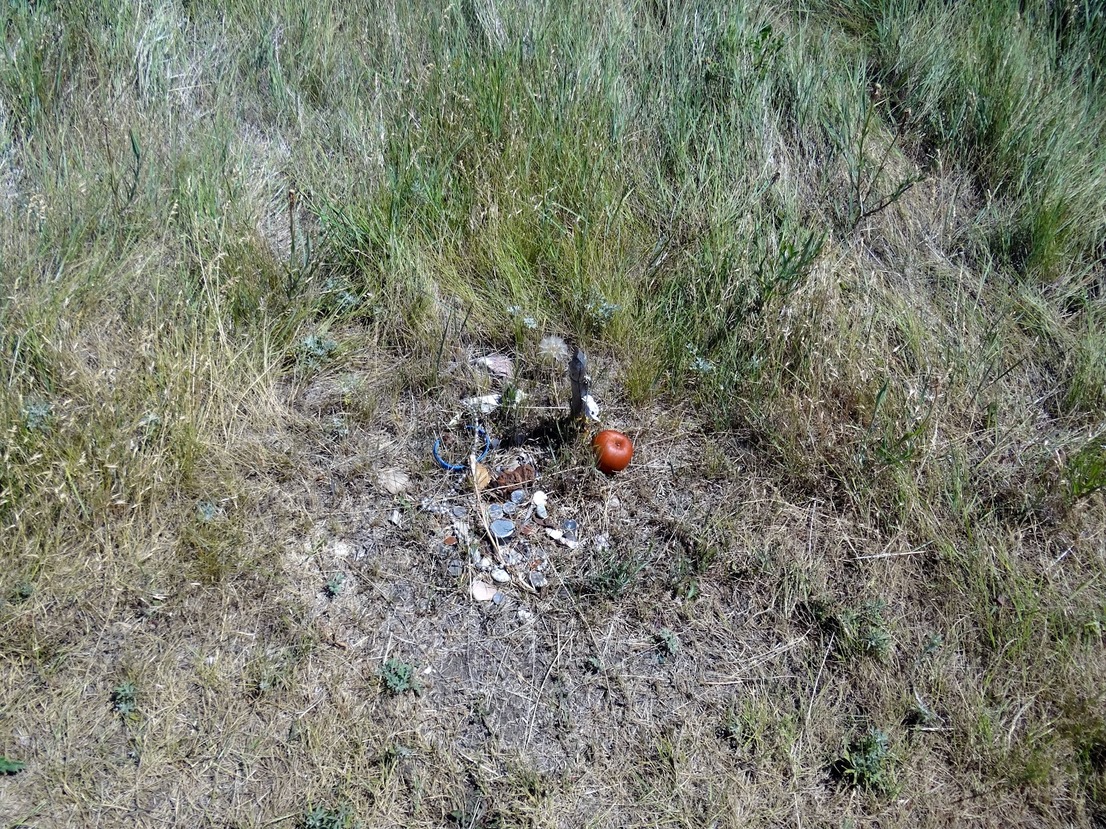
 Thr trail guide explained the alignment of both the Nez Perce and the US troops.  Along the early part of the trail, down in the coulee, there were small stell markers that the NPS had planted, that showed where each lodge (teepee) was located and what chief or family occupied it during the battle.  And most of them had items of interest that had been offered as a memory to them, andwe were told that they were sacred to the those who had left them.  I assume that they were descendants of the families.
 While walking thru this battlefield, which has been transformed into a soloemn, sacred place to many, gave me a sad feeling once again of the struggles so many Native Americans endured during a dark time of our history.  I paused a couple of times while walking, and the stiff wind was telling me something.  While reading each story plaque, visions of the children, women, elderly and suffering of the wounded warriors as well as the many soldiers who were strewn about the fields, were being flashed in my head.  Using my imagination, the wind was telling me that the spirits of the that time, here at this place, did not want us to tary as it belonged to them. 
 The coulee above provided relief from the wind and elements for the camp of the Nez Perce.  After so many miles of marching away from the troops, this place afforded some relief for much needed rest for the weak and elderly.
 Behind this stone is the indented furrow of land where the soldiers were buried.
 Many of the lodge locations, as well as the rifle pit where Chief White Bird, Chief Looking Glass and Chief Ollokut, (Chief Joseph's brother) were killed, were decorated with offerings like this.
 Above is the memorial plaque where Chief Joseph surrenered his rifle to General Howard, and below is an artist's rendering of the event, in the Chinook Museum.
Well, that's about all we gathered for this blog.  It truly is rewarding to research the many writings of the accounts of the plights & struggles of the Native Americans who called this part of the world, home, for so many generations.  So, till the next time, Nancy & Joe, the RVing Beach Bums rolling on down the highway.