Joe and Nancy

Joe and Nancy
Our Home on Wheels (Click on image above for our web albums.)

Friday, October 31, 2014

Porcupine Mountains Wilderness State Park, UP, MI (Part 1)

We camped out here at the Union Bay Modern facility, 9/5-9/8.  This was a real jewel of a place to stay and play.  We mostly hiked, and went on several ranger-led hikes as well.  In fact, we did so much while here, and the weather mostly cooperate, that it will take me three blogs to cover all the things we did and we have plenty of pics to share as well.  When we left Munising on Sept 4, we knew were going to drive thru a weather front about the time we would arrive in Marquette.  So we decided to drive to the Walmart there and ride out the storm in their parking lot.  Next morning, weather was nice, so we headed on to the Ontanogan area and the Porcupine Mountains Wilderness State Park.
One of the first things we did was to take a 30 mile drive to the other side of the Park and hike up Summit Peak.  Whew!  It was a pretty strenuous hike, but well worth it.
Some of us needed a break now and then.  The benches were in just the right places it seemed.  Below, Nancy preparing herself for trek up the steps to the lookout tower.
Beautiful Lake Superior in the distance...from the tower...
Nancy catching a ray and her breath...It was quite breezy up here on top of the world.
I caught her taking my picture from down below the tower.
Now the walk back down to the parking lot about a mile away.  Couldn't resist the web of a local arachnid. 
Below, a little background info...
Here a couple pics of some story boards that do a better job of explaining the geography than I could.
Later that afternoon, we drove back to the campground and on past to the "End of the Earth", as the road sign depicted earlier in this blog.  Also there at the "end" was Lake of the Clouds.  Another short hike up the hill took us to a beautiful overlook of the lake and the surrounding park forest and views.
The Scenic Lookout at Lake of the Clouds Scenic Area is probably the most popular attraction for day visitors to the Porkies and one you ought not to miss.  The lake is not very deep, 15 feet or so, like a marsh lake, and is about 200 acres I would guess.
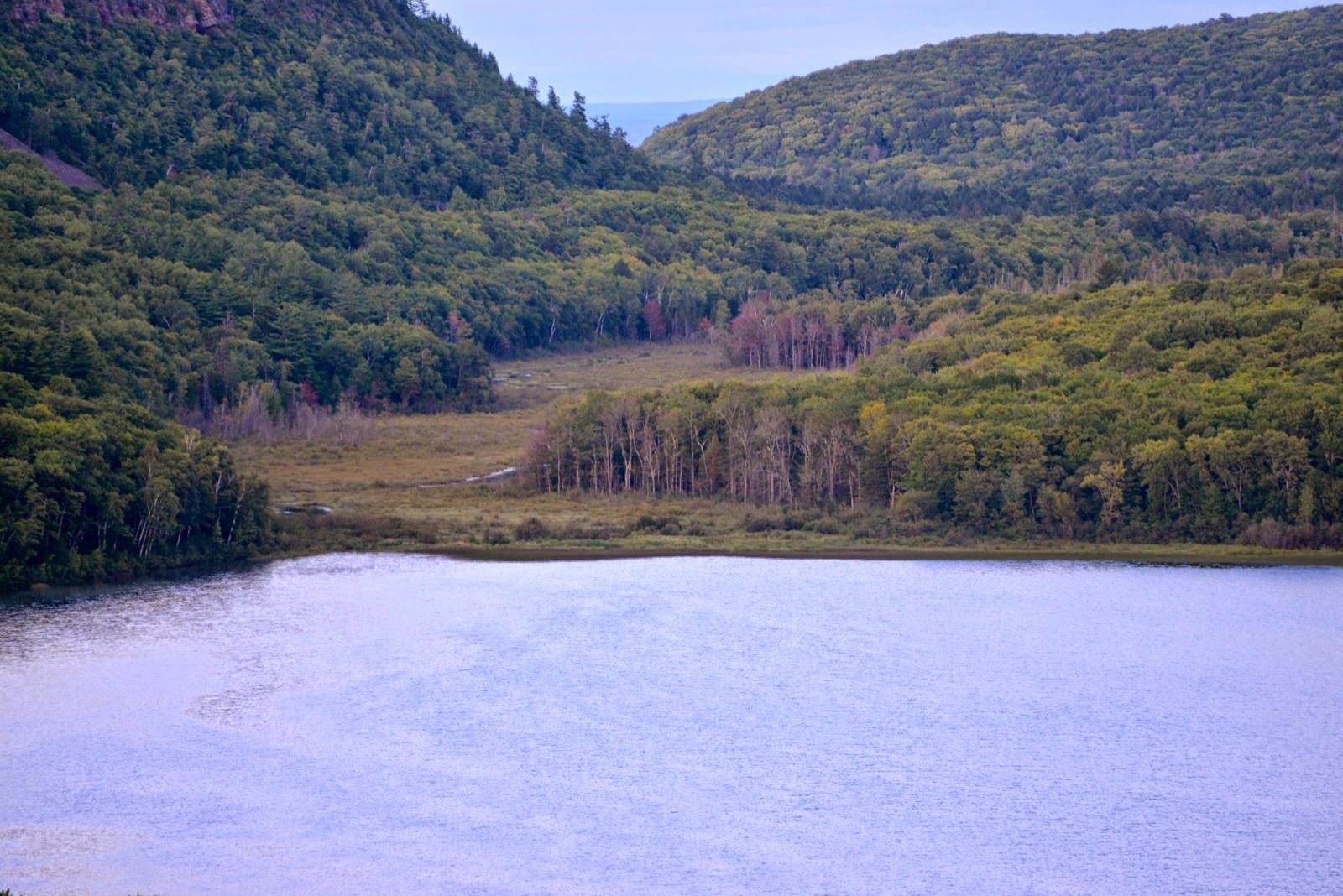
lake of the clouds porcupine mountains park
Looking west from the Lake of the Clouds overlook, and below, Nancy looking east and behind her would be the lake.
Note the footbridge crossing the lower part of the lake, which is Carp River at this point.  The bridge is along one of the many trails in the park.  We enjoyed the cool weather and mostly dry skies as it made for good hiking.
Well, that about wraps up part 1 of our stay in the "Porkies".  Until the next blog, Porkies part 2, RVing Beach Bums signing off.  This blog written and published from our home in Virginia Beach, Oct 31.


Pictured Rocks National Lake Shore, UP, MI


After we left Tahquamenon Falls State Park Sept 1, we headed west down Highways 128 and 23 into Munising on the southern shore of Lake Superior, and parked the Diplomat at Munising Tourist Park Campground.  Munising is about 40 miles or so east of Marquette.  Next day was nice, so we decided to do the boat tour out to the pictured rocks.  Below is the boat we boarded around noon for the approx 3 hour round-trip excursion out to the pictured rocks.
The colors just kept getting better the further we cruised.  The boat was nearly a sellout, and I think there were like a hundred or so folks on board.  Above I'm standing at the back of the upper deck, which I was politely asked not to stand there, because it was near the stairwell.  
What we found amazing is how these rocks (er, cliffs) just seemed to suspend majestically as sentinels of Lake Superior's southern coastline.  Below, in time, I got to believe that this Hemlock will falling into the lake along with it's supporting rock.
Below, one of the many streams that were pouring their cargo into the cold, deep lake. 

we saw several trees precariously perched on the granite/sandstone cliffs.  Green rocks usually meant high concentrations of copper.  UP has numerous copper mines scattered about.

I caught Miss Nancy snapping off a pic for her iphone, which was probably for an email to our daughters.
Above, one of the rental pontoon boats from the Munising Marina in close to the rocks.
The leaching minerals from the tree roots, rocks and other chemical make-up of the soil makes for natural portraits painted only as Mother Nature can.  
The hundred or so folks on the boat tended to migrate to the starboard (right, for you non-nautical types) side of the boat.  So much so, that I, along with others, had a hard time keeping our balance. 
Just awesome!  We saw several areas where large chunks of the cliffs tumbled into the lake's shoreline.
The water here was so clear and cold.  From Wiki:  Lake Superior is the largest of the Great Lakes of North America. The lake is shared by Canada's Ontario and the United State's Minnesota to the north and west, and Wisconsin and Michigan to the south. It is generally considered the largest freshwater lake in the world by surface area. It is the world's third-largest freshwater lake by volume and the largest by volume in North America.
From Wiki:  The U.S. Congress made Pictured Rocks the first officially designated National Lakeshore in the United States in 1966. It is governed by the National Park Service (NPS), had 22 year-round NPS employees as of May 2006, and received 476,888 visitors in 2005.
Below, this large breakaway will one day plunge into the lake and will make quite a splash for sure.
Below, notice folks looking left (return trip back to the marina).  The folks on the upper deck were more on the port side of the boat, causing it to list a little to the port side.  Not bad here though, because everyone got their photos on the outbound portion of the cruise.
Below was a lookout out near the Miner's Castle area of the National Lakeshore Park.  We did drive out to here later that day, and some of our pics are shown below.

Below, from Wiki:  The Grand Island East Channel Light is a lighthouse located just north of Munising, Michigan and was intended to lead boats from Lake Superior through the channel east of Grand Island into the Munising Harbor. Constructed of wood, the light first opened for service in 1868.
Below, we passed the 3 o'clock cruise outbound with it's passengers.
Here are a few pics from and at the overlook previously shown in this blog when were in the boat.  Look how clear that water is.
The next few pics were around and at the old retired US Coast Guard Station, which is now a museum maintained by the NPS within the park.
We had us a beautiful weather day for enjoying the gorgeous aesthetics of the lake shore and Grand Island, in the distance above, and to the north.  Below, looking east from the coast guard station. 
Here are a few more pics of the awesome Pictured Rocks Lake Shore.

Below, Battleship Rock...
From wiki:  Miners Falls is a waterfall located on Miners River in the western portion of the Pictured Rocks National Lakeshore in Alger County, Michigan. The falls drops about 40 feet over a sandstone outcrop with a 10-foot crest. The falls can be accessed by trail, with stairs leading to a lookout.
Below, the trail leading to Miners Falls.  It was about a mile round trip walk.
 It's a beautiful walk and the reward at the end is well worth it. Breathtaking!
We stayed on the main path and didn't go to the upper level, as it is closed to the public (safety), but the view from the lower level is fantastic. The walk is along a paved pathway which follows a rushing stream, and there are a lot of very pretty vantage points and photo ops along the way. 
This waterfall is truly gorgeous.
The blow pic was borrowed from the web.  Obviously we weren't there when the falls is an ice column.  Just thought I'd share a pic of what it looks like in January.
 
The water color was stained with the tannins from the leaching of the forest tree roots.

Right across the small creek from the visitor's center at the falls, is story board of an iron furnace that once smelted the ore that came from the mines around the Marquette area in the mid 1800's.  No visible remnants remain however, just a memory and old pics.  Below is all that one can view of the site where it once stood.
Well, that about wraps up our visit in and around the Munising, MI area on the UP.  Next stop:  Porcupine Mountains State Park, to the west about 100 miles, still on the UP.  Till then, RVing Beach Bums signing off.  This blog was written & published from our home in Virginia Beach on Oct 31.